 |
|
 29-01-2009, 05:27
|
#16
|
|
Sponsoring Vendor


Join Date: Jan 2009
Location: East of West
Posts: 252
|
Quote:
Originally Posted by wlearl

It is bare bones but it will provide a simple way for me to have a lot of charts for backup and special purposes. Now I've got to figure out exactly which charts are the ones I need.
Is there some place, other than taking up space on this board where we might send comments and suggestions for features? Will you be informing alpha testers of upgrades and improvements via some simple email or website? I'm happy to try it out because it satisfies one of my needs for backup charts but I'd prefer to not use up too much "sailing space" for software discussions.
Bill |
Bill, you can contact us by visiting the website and going to feedback page or by email (go to Help->About on Windows or PolarView->About on Mac, the information is listed in the information box). I'd rather not post the email address on the forum to avoid spam bot harvesting for as long as possible.
Since we don't have an "opt-out" email system yet, we probably won't be sending email notifications to everyone, but if you want to be notified - mention it in your email and we will be glad to let you know when next version is available. The information will likely be posted here too.
Did you find the keyboard controls convenient? Were they easy to find? Did they require an effort to remember?
|

|

|
|
29-01-2009, 05:38
|
#17
|
|
Registered User
Join Date: May 2006
Location: Hampton Roads, va
Boat: Catalina 387 - Magical Dreamer
Posts: 176
|
ok, now that the first round have risked their systems, I will drop it into a VM and bang on it for a while as I have time.
Please give a location to send the list of bugs found and suggested enhancements.
|
|
|
|
|
29-01-2009, 06:19
|
#18
|
|
Sponsoring Vendor
Join Date: Jan 2009
Location: East of West
Posts: 252
|
Quote:
Originally Posted by Doghouse
ok, now that the first round have risked their systems, I will drop it into a VM and bang on it for a while as I have time.
Please give a location to send the list of bugs found and suggested enhancements.
|
When you open the application, press F1 (or select Help->About) - the email and web contact forms are listed there. We would appreciate your feedback!
P.S. For everyone:
A major UI bug was discovered and fixed in a Mac version. A new image is available for download. Please make sure your current product version (as listed in Help->About dialog) for Mac is 0.2.263 or higher.
|
|
|
|
|
29-01-2009, 06:39
|
#19
|
|
Registered User
Join Date: Feb 2007
Boat: 1973 Morgan 36T
Posts: 808
|
It seems to run fine here.
Windows XP Profesional service pack 3
AMD Athlon 64x2 Duel
1.93 GB Ram
|
|
|
|
|
29-01-2009, 07:28
|
#20
|
|
Registered User
Join Date: Jan 2008
Location: SE PA
Boat: Baba 35 - One With The Wind
Posts: 392
|
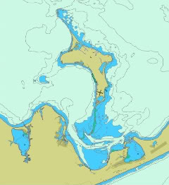
The app installed here on WinXP without a hitch. Looking at a chart of Baltimore Harbor, things work well enough and the image looks darn good. Changing the depth units worked smoothly and I can retrieve object data. At a minimum, though, I'd add, ASAP, some sort of default "the charts are here" option (and at least a thumbnail of the charts, please!, until quilting is up and running). Where do you see the app going from this point? What's in store for Alpha2 and what's your current end state? Freeware? Shareware? Commercial app?
__________________
S/V One With The Wind
'85 Baba 35
"You and I may agree, but we could both be wrong."
|
|
|
|
|
29-01-2009, 08:12
|
#21
|
|
Moderator Emeritus
Join Date: Sep 2007
Location: Eastern Tennessee
Boat: Research vessel for a university, retired now.
Posts: 10,406
|
Quote:
Originally Posted by twisty
Download AVG Free edition. You should really be running something like this to begin with  AVG won't pick up EVERYTHING but it is better than most paid programs. In 5 years I have never had a problem with Virus's, Trojans, Spyware or Adware, and you should see some of the sites I am required to visit and download crap from!
There is actually a suite of programs I run(All Free) for anyone that is interested. AVG Free, Spyware Blaster, Spybot Search and Destroy and Adaware. Keep them updated and you shouldn't have to worry about to much. |
Thanks Twisty,
I run AVG already. I don't want to sidetrack this thread but I did not know if there was any anti-malware software that can look at a file and detect malware before it is installed. I don't know if AVG or any other malware software can do that. Its sort of a non-issue now for brak's software in particular.
Thanks for the chance to alpha test your software brak. Was it written to work with Vista 64? That is what I am using.
__________________
David
Life begins where land ends.
|
|
|
|
|
29-01-2009, 08:51
|
#22
|
|
Registered User
Join Date: Jan 2009
Posts: 105
|
All I'm seeing is map outlines -- no other chart data.
Should I be seeing all the chart data?
(I'm on a MacBook Pro, running 10.5.5)

|
|
|
|
|
29-01-2009, 09:28
|
#23
|
|
Registered User
Join Date: Jan 2009
Posts: 203
|
Quote:
Originally Posted by David M
Thanks Twisty,
I don't know if AVG or any other malware software can do that.
|
The latest version of AVG can(With FireFox anyways)
Your welcome!
|
|
|
|
|
29-01-2009, 09:29
|
#24
|
|
Registered User
Join Date: Jan 2008
Location: SE PA
Boat: Baba 35 - One With The Wind
Posts: 392
|
In my test in Baltimore, I saw everything I'd expect to find in a chart. Lights, depths, channels, etc., etc. The ENC is US5MD11M.000
__________________
S/V One With The Wind
'85 Baba 35
"You and I may agree, but we could both be wrong."
|
|
|
|
|
29-01-2009, 09:46
|
#25
|
|
Sponsoring Vendor
Join Date: Jan 2009
Location: East of West
Posts: 252
|
David,
The issue has been reported on some Macs and we are working to localize it - it is one that does not want to replicate properly in our lab. Would you mind providing your system information (found by selecting "About this Mac -> More information" menu, in particular the amount of memory in your machine may be useful). Send it to us by PM here or through feedback form on the website.
We are working on a diagnostic utility specifically to localize this problem (ETA sometime next week). Would you be willing to try it on your machine?
Quote:
Originally Posted by DavidGC
All I'm seeing is map outlines -- no other chart data.
Should I be seeing all the chart data?
(I'm on a MacBook Pro, running 10.5.5)
 |
|
|
|
|
|
29-01-2009, 09:50
|
#26
|
|
Sponsoring Vendor
Join Date: Jan 2009
Location: East of West
Posts: 252
|
Quote:
Originally Posted by David M
Thanks for the chance to alpha test your software brak. Was it written to work with Vista 64? That is what I am using.
|
The program is theoretically  designed for widest compatibility (as you can see from Mac and Windows versions being available). It has been tested on Vista 32, but not on Vista 64 bit version - so the answer is "we don't know yet". We would be extremely interested in your experience if you choose to try it.
|
|
|
|
|
29-01-2009, 09:56
|
#27
|
|
Sponsoring Vendor
Join Date: Jan 2009
Location: East of West
Posts: 252
|
Could you elaborate on the "charts are here" and thumbnail options? Were you able to load multiple chart cells? What was the display like if you did that?
That said, chart management is on the least of "definitely needed" features.
We don't know yet where the application will end up - we've got to learn to crawl before we walk. For now the focus is on application and the objective is to improve existing feature set until users are happy with how things work, fix existing problems and then expand featureset appropriately.
Quote:
Originally Posted by RBEmerson
The app installed here on WinXP without a hitch. Looking at a chart of Baltimore Harbor, things work well enough and the image looks darn good. Changing the depth units worked smoothly and I can retrieve object data. At a minimum, though, I'd add, ASAP, some sort of default "the charts are here" option (and at least a thumbnail of the charts, please!, until quilting is up and running). Where do you see the app going from this point? What's in store for Alpha2 and what's your current end state? Freeware? Shareware? Commercial app? |
|
|
|
|
|
29-01-2009, 10:21
|
#28
|
|
Moderator Emeritus
Join Date: Mar 2003
Location: Hayes, VA
Boat: Gozzard 36
Posts: 8,700
|
Quote:
|
It has been tested on Vista 32, but not on Vista 64 bit version - so the answer is "we don't know yet".
|
Works fine under Vista 64. It installs as a 32 bit application. I played with a bit more. It quilted up 3 charts OK. Be nice to have a mouse rectangle zoom. Perhaps a tool bar. It does not zoom in or out far enough though. If you grab all the VA and MD Bay charts it points out that you need to be able to quilt up a bunch of charts. It means you need handle at least 3 zoom scales that automatically change the display for you. Some systems use a layer selector but that really sucks. You sort of have the idea now where details come and go. Adding a more flexible colored depth boundaries where you can set the different levels.
I can load all the US ENC charts from NOAA under Fugawi and zoom around. Thats about 1 GB of maps. I can also preload groups of maps. You should add something that can let you install all the maps but define regions of maps for loading. I may have all the maps but I might only use about 25 at a time.
A few tools like a line mode for making begin and end point and then display distance and bearing true or magnetic is need for a real viewer only application The basic rendering seems to work.
I would be curious if you have purchased the full set of ENC standards documents?
__________________
Paul Blais
s/v Bright Eyes Gozzard 36
37 15.7 N 76 28.9 W
|
|
|
|
|
29-01-2009, 13:55
|
#29
|
|
Sponsoring Vendor
Join Date: Jan 2009
Location: East of West
Posts: 252
|
The automatic chart manager is on the must-have feature list. Once it is in place, zoom levels may be adjusted. At this point, smallest scale at which each chart is still shown at all is already significantly less than a scale of the chart itself.
There are a few hard rules that were set upon before autoscale was implemented. Any marine danger objects are drawn regardless of scale (other than as required in ENC data itself) and will not auto-scale out except with the entire chart turned off. This is an obvious safety feature. Other objects are more flexible and we will be continously adjusting the algorithm based on user feedback. Ideally, there will be very few chart controls except for general preferences.
Lack of toolbar is a design decision and will be maintained unless there is a compelling reason to do otherwise. Some of the motivation for the application included clearer and more seamless charts, and ability to access every feature using simple keystrokes (and mouse, to an extent). Toolbars take valuable screen space that is better used for chart information. Toolbars also mean that user must select certain tools or features from toolbar menu, before s/he is able to use them. Ideally, in our design, any feature should be available at all times without additional selection from a menu or a toolbar, by pressing an appropriate key/shortcut. That does mean that we really need user feedback on key assignment and convenience.
Were you able to load more than 3 cells at a time? The very first release on our site was limited to 3 cells by mistake - this is fixed now, limit is 10 cells.
There are numerous features, which are either not developed yet or were omitted from Alpha v1 for simplicity. Visual chart presentation is a first priority for marine ENC application. We need to perfect the available featureset, and as feedback shows - there is work to be done.
All the S57 standard documentation is available for download from International Hydrographic Organization.
Quote:
Originally Posted by Pblais
Works fine under Vista 64. It installs as a 32 bit application. I played with a bit more. It quilted up 3 charts OK. Be nice to have a mouse rectangle zoom. Perhaps a tool bar. It does not zoom in or out far enough though. If you grab all the VA and MD Bay charts it points out that you need to be able to quilt up a bunch of charts. It means you need handle at least 3 zoom scales that automatically change the display for you. Some systems use a layer selector but that really sucks. You sort of have the idea now where details come and go. Adding a more flexible colored depth boundaries where you can set the different levels.
I can load all the US ENC charts from NOAA under Fugawi and zoom around. Thats about 1 GB of maps. I can also preload groups of maps. You should add something that can let you install all the maps but define regions of maps for loading. I may have all the maps but I might only use about 25 at a time.
A few tools like a line mode for making begin and end point and then display distance and bearing true or magnetic is need for a real viewer only application The basic rendering seems to work.
I would be curious if you have purchased the full set of ENC standards documents? |
|
|
|
|
|
29-01-2009, 14:11
|
#30
|
|
Registered User
Join Date: Jan 2009
Posts: 105
|
I would re-think the tool bar.
I would rather give up a narrow strip of chart space -- even if it was just small icons, the function of which was labeled when I rolled over them with a mouse -- than to have to memorize keystroke shortcuts. What I (and other old guys like me with lousy memories for which shortcuts go with which program) would end up doing would be going up to the menu every time I want to do something.
You could have the best of both worlds if you made the toolbar something the user could choose to have on or off -- even better if I could choose which functions appeared on the toolbar, so I could customize it to have only the functions I wanted.
DCM
|
|
|
|
|
|
| Thread Tools |
Search this Thread |
|
|
|
| Display Modes |
Rate This Thread |
 Linear Mode Linear Mode
|
|
 Posting Rules
|
You may not post new threads
You may not post replies
You may not post attachments
You may not edit your posts
HTML code is Off
|
|
|
|
Advertise Here

 Recent Discussions Recent Discussions |
|
|
|
|
|
|
|
|
|
|
|
|
|
|
|
|
|
|
|
|
|
|
|
|
|
Vendor Spotlight |
|
|
|
|
|
|
|
|
|


