 |
 22-09-2020, 10:03
|
#1
|
|
Registered User

Join Date: Jan 2019
Location: Montreal, Canada
Boat: 1974 Pearson 26
Posts: 189
|
Avionics charted depths....
Are the depths displayed on Navionics screens datum or actual?
Thx
|

|

|
|
22-09-2020, 10:45
|
#2
|
|
Registered User
Join Date: Jan 2019
Location: Montreal, Canada
Boat: 1974 Pearson 26
Posts: 189
|
Re: Avionics charted depths....
Not actual but are the depths shown equivalent to the hydrographic charts?
|
|
|
|
|
22-09-2020, 10:56
|
#3
|
|
Registered User
Join Date: Jan 2011
Location: Cowichan Bay, BC (Maple Bay Marina)
Posts: 9,705
|
Re: Avionics charted depths....
Any quality chart packages should give you the datum they use, just like paper charts. In many electronic chart packages, a right click will tell you what chart they are using.
__________________
Stu Jackson
Catalina 34 #224 (1986) C34IA Secretary
Cowichan Bay, BC, SR/FK, M25, Rocna 10 (22#) (NZ model)
|
|
|
|
|
22-09-2020, 11:00
|
#4
|
|
Registered User
Join Date: Apr 2019
Posts: 1,360
|
Re: Avionics charted depths....
Quote:
Originally Posted by Rol1964

are the depths shown equivalent to the hydrographic charts?
|
generally yes . . . except it has been shown they have occasional (pretty significant) machine translation errors, and sometimes they have overwritten the charted depths based on user feedback (which has sometimes been accurate and other times not).
|
|
|
|
|
24-09-2020, 07:58
|
#5
|
|
Registered User
Join Date: Jan 2019
Location: Montreal, Canada
Boat: 1974 Pearson 26
Posts: 189
|
Re: Avionics charted depths....
Quote:
Originally Posted by Stu Jackson
Any quality chart packages should give you the datum they use, just like paper charts. In many electronic chart packages, a right click will tell you what chart they are using.
|
I just purchased Navionics for Canada and USA. Right click doesn't yield any info. I must be overlooking something very obvious cause it doesn't indicate anywhere, what datum it's based on.
|
|
|
|
|
24-09-2020, 09:29
|
#6
|
|
Registered User
Join Date: Apr 2013
Location: British Columbia
Boat: Sceptre 41
Posts: 1,941
|
Re: Avionics charted depths....
If you are using the Navionics Android App (and perhaps Ios) :
App has a "water level correction" option. If you turn it on (I don't!), it corrects water levels based on the factor you enter in a map option below. If turned off or correction set to "0", then level indicated is usually same as official charts (at least for Canada), with small error occasionally due to conversion (eg if you view depths in feet but original chart is in metres).
I rarely "depend" on Navionics (i. e., I might view when planning, but do not navigate with them), but I do not use the water level "correction" feature. I could imagine an error where one sets one level and then forget to revise it when using at a later time with a different tide level. Best to stick with known datum.
|
|
|
|
|
24-09-2020, 10:00
|
#7
|
|
Registered User
Join Date: Jan 2010
Location: Mystic, CT
Boat: Holby Clearwater 35 -SeaScape
Posts: 23
|
Re: Avionics charted depths....
Quote:
Originally Posted by Breaking Waves
generally yes . . . except it has been shown they have occasional (pretty significant) machine translation errors, and sometimes they have overwritten the charted depths based on user feedback (which has sometimes been accurate and other times not).
|
The user feedback (e.g., sonar chart view) is questionable, IMHO. You dont know about the user depth sensor calibration or otherwise know how the user data is indexed to the vertical datum. Boater beware!
|
|
|
|
|
24-09-2020, 10:14
|
#8
|
|
Registered User
Join Date: Apr 2013
Location: British Columbia
Boat: Sceptre 41
Posts: 1,941
|
Re: Avionics charted depths....
I have zeen Navionic's "sonar charts" that are nonsensical: they were clearly/simply interpolations of official (and often widely spaced) soundings. Garbage.
As for user-contributed soundings: did they calibrate their sensor? Did they (and how) account for tide level?
No, I don't trust them. (And take all user-contributed data, such as Active Captain with a vrain of salt.)
|
|
|
|
|
24-09-2020, 10:17
|
#9
|
|
Registered User
Join Date: Apr 2013
Location: British Columbia
Boat: Sceptre 41
Posts: 1,941
|
Re: Avionics charted depths....
But I was trying answer Rol1964's (the OP) question about Navionics (rather than trash user contributions).
Not sure if Navionic's chart CARDS have same options/issues....
|
|
|
|
|
24-09-2020, 10:56
|
#10
|
|
Registered User
Join Date: May 2015
Location: Muskegon, Mi
Boat: Columbia 36
Posts: 1,210
|
Re: Avionics charted depths....
I just started experimenting with Navionics this year and was wondering about that. The soundings and contour lines appear to be much more detailed than the official charts. I have to wonder where they got the data. Kinda doubt they went out and did their own surveys. And as others have said if it's user contributed you can't rely on any of it.
|
|
|
|
|
24-09-2020, 17:53
|
#11
|
|
Registered User
Join Date: Jan 2019
Location: Montreal, Canada
Boat: 1974 Pearson 26
Posts: 189
|
Re: Avionics charted depths....
And...my mobile devices indicate 32 ft of clearance for a particular bridge but the same bridge indicates 42 ft on my desktop...? Any ideas?
|
|
|
|
|
24-09-2020, 20:54
|
#12
|
|
Registered User
Join Date: Jul 2018
Location: SF Bay Area
Boat: Other people's boats
Posts: 1,108
|
Re: Avionics charted depths....
Quote:
Originally Posted by Stu Jackson
Any quality chart packages should give you the datum they use, just like paper charts. In many electronic chart packages, a right click will tell you what chart they are using.
|
This would be a good feature request. When you hit the question mark button for a location Navionics lists a number of properties, e.g. "Pacific Leatherback Conservation Area" that you can expand for more details. It seems reasonable to me that the expanded details for a sounding or depth zone should include the CATZOC or survey details.
Quote:
Originally Posted by fcallard
The user feedback (e.g., sonar chart view) is questionable, IMHO. You dont know about the user depth sensor calibration or otherwise know how the user data is indexed to the vertical datum. Boater beware!
|
It occurs to me that the the bathymetry from the sonar readings could be analyzed for a "best fit" to existing soundings based on position. You have soundings at specific coordinates on the official charts, so find the corresponding positions in the sonar data and calculate the average offset based on that. That way you needn't worry how the user calibrated their sensor. Just a random thought, of course.
Quote:
Originally Posted by Rol1964
And...my mobile devices indicate 32 ft of clearance for a particular bridge but the same bridge indicates 42 ft on my desktop...? Any ideas? |
No idea. Any bridge in particular?
|
|
|
|
|
24-09-2020, 21:35
|
#13
|
|
Registered User
Join Date: Aug 2011
Location: Petersburg, AK
Boat: Outremer 50S
Posts: 4,229
|
Re: Avionics charted depths....
Quote:
Originally Posted by capt jgw
I just started experimenting with Navionics this year and was wondering about that. The soundings and contour lines appear to be much more detailed than the official charts. I have to wonder where they got the data. Kinda doubt they went out and did their own surveys. And as others have said if it's user contributed you can't rely on any of it.
|
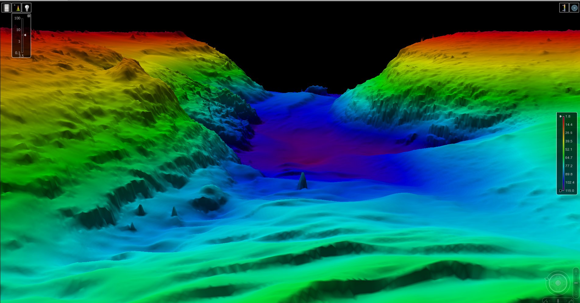
I don’t know anything about Navionics’ chart development process, but I do assist NOAA with maintenance of some of their hydrographic survey vessels. A NOAA chart doesn’t remotely show all of the bathymetric data collected by NOAA, but NOAA does make that data available. You can see what NOAA makes available at their website.
If you take a look at one of their “smooth sheets” overlaid on a chart you’ll see there are hundreds of actual soundings for each sounding label displayed on a chart. So, if Navionics uses the smooth sheets or BAG models (I don’t know that they do, only that data is available) they could provide much more detailed contours than found on standard charts.
Here’s a NOAA surface map image of part of San Francisco Bay that shows some of the additional data available:
And a smooth sheet showing all the soundings for a location overlaid on the actual chart (sorry, it’s a PDF, that’s what NOAA posted):
https://www.ngdc.noaa.gov/mgg/bathym...moothsheet.pdf
|
|
|
|
|
25-09-2020, 05:01
|
#14
|
|
Registered User
Join Date: Jan 2019
Location: Montreal, Canada
Boat: 1974 Pearson 26
Posts: 189
|
Re: Avionics charted depths....
Quote:
Originally Posted by requiem
This would be a good feature request. When you hit the question mark button for a location Navionics lists a number of properties, e.g. "Pacific Leatherback Conservation Area" that you can expand for more details. It seems reasonable to me that the expanded details for a sounding or depth zone should include the CATZOC or survey details.
It occurs to me that the the bathymetry from the sonar readings could be analyzed for a "best fit" to existing soundings based on position. You have soundings at specific coordinates on the official charts, so find the corresponding positions in the sonar data and calculate the average offset based on that. That way you needn't worry how the user calibrated their sensor. Just a random thought, of course.
No idea. Any bridge in particular?
|
Pont Galipeault at Canal Sainte Anne - just west of island of Montreal.
Mobile gives 9.9 meters and desktop says 13.5 meters. But I found my error (the height entering the lock is higher than the rest of the bridge - difficult to pinpoint with phone screen) so looks like my boat will fit. 
|
|
|
|
|
| Thread Tools |
Search this Thread |
|
|
|
| Display Modes |
Rate This Thread |
 Linear Mode Linear Mode
|
|
 Posting Rules
|
You may not post new threads
You may not post replies
You may not post attachments
You may not edit your posts
HTML code is Off
|
|
|
|
Advertise Here

 Recent Discussions Recent Discussions |
|
|
|
|
|
|
|
|
|
|
|
|
|
|
|
|
|
|
|
|
|
|
|
|
|
Vendor Spotlight |
|
|
|
|
|
|
|
|
|


