 |
 11-02-2013, 03:23
|
#1
|
|
Registered User

Join Date: Feb 2013
Location: Lower Austria
Boat: Belliure Endurance 35
Posts: 19
|
Offset of grid after import of KAP files
Hi!
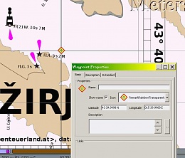
I am the developer of Smrender, an OSM-based seachart renderer ( smrender – A Rule-based Renderer for OSM Data). I implemented KAP/BSB file creation a few months ago. Today I compiled and install OpenCPN to test the KAP code again.
It turns out that there is an offset between the internal grid of OpenCPN and the grid of my KAP files. It tested the same files also with the "Marine Navigator" for Android which shows no offset, i.e. its coordinate system is equal to the one of my KAP file.
Is there any OpenCPN dev around that we can investigate together where this offset comes from?
It also says that the chart has a poor geo reference although I put 6 reference points into the header.
There is an example file:
http://www.abenteuerland.at/download...les/murter.kap
Best regards,
Bernhard
|

|

|
|
11-02-2013, 08:49
|
#2
|
|
Registered User
Join Date: Dec 2010
Location: B.C.,Canada
Boat: 29'
Posts: 2,423
|
Re: Offset of grid after import of KAP files
rahra,
yes, there is a shift in your kap....so.
I quickly stripped out your image and recalibrated with just 2 points in MapCal_2...made a kap
and it works fine in O....
So, try just two diagonal cal points on the "obvious" lat/longs and see.
|
|
|
|
|
11-02-2013, 09:02
|
#3
|
|
Registered User
Join Date: Dec 2005
Location: Helsingborg
Boat: Dufour 35
Posts: 3,891
|
Re: Offset of grid after import of KAP files
rahra
Just a simple error.
I found no reason to treat the chart as Transverse Mercator. The limiting longitudes are parallel, indicating a Mercator Chart. Changing the header to PR=MERCATOR, sorted the chart out.
Alternatively, if you insist that this is a T Merc chart, the PP value is wrong. You have it based on the latitude, which is OK for Mercator Charts. For Transverse Mercator charts you have to use the average longitude of the eastern and western edge.
I have not tested this approach. The end result is likely to be close, as well but probably not as good as just changing the header, described above.
Thomas
|
|
|
|
|
11-02-2013, 18:25
|
#4
|
|
Registered User
Join Date: Dec 2010
Location: B.C.,Canada
Boat: 29'
Posts: 2,423
|
Re: Offset of grid after import of KAP files
good point,Thomas!
I was wondering too..per why TM? but what the hay,
...so I called it TM anyways( BUT forgot to include the avg long(sloppy!!  ) - still, it worked as per grid suprising well.
! Created by mc2bsbh beta09 - Use at your own risk!
VER/2.0
BSB/NA=murterOSM
NU=1,RA=2480,3508,DU=601
KNP/SC=200000,GD=WGS84,PR=TRANSVERSE MERCATOR,PP=15.5833
PI=UNKNOWN,SP=UNKNOWN,SK=0.0,TA=90.0
UN=METERS,SD=UNKNOWN
DX=8.45,DY=8.45
OST/1
REF/1,291,659,43.8333333,15.5
REF/2,1872,2847,43.6666667,15.6666667
CPH/0.0
PLY/1,43.8831235,15.4697139
PLY/2,43.6166706,15.4702168
PLY/3,43.6166324,15.7300242
PLY/4,43.883085,15.7306764
DTM/0,0
IFM/7
(MapCal2, which showed grid ok! and then mc2bsbh via HelpCal used here)
|
|
|
|
|
12-02-2013, 08:53
|
#5
|
|
Registered User
Join Date: Feb 2013
Location: Lower Austria
Boat: Belliure Endurance 35
Posts: 19
|
Re: Offset of grid after import of KAP files
Thanks, I got it.
|
|
|
|
|
| Thread Tools |
Search this Thread |
|
|
|
| Display Modes |
Rate This Thread |
 Linear Mode Linear Mode
|
|
 Posting Rules
|
You may not post new threads
You may not post replies
You may not post attachments
You may not edit your posts
HTML code is Off
|
|
|
|
Advertise Here

 Recent Discussions Recent Discussions |
|
|
|
|
|
|
|
|
|
|
|
|
|
|
|
|
|
|
|
|
|
|
|
|
|
Vendor Spotlight |
|
|
|
|
|
|
|
|
|


