Use for
racing does not necessarily mean weather routing, you can also plan your waypoints and navigate to them or look at your opponents on
AIS or...
Especially on sailing boats, pretty much everybody does weather routing all the time, what differs are the data and tools used. And they differ a lot - from v1 eyeball and a little common sense to computer aided "scientific"
route planning using digital weather models.
The kind of grib data that made you start this thread, for example, is good to do weather routing from SF to
Hawaii, but in
SF bay, Tahoe or other small
water body, it is of course pretty much useless for similar purposes and local knowledge and
current meteo situation are far superior to plan your
route.
If you can get Grib data with resolution better than say 0.1 deg, they start to be useful even in more constrained areas (Still I have to see one really usable on a lake in the middle of the mountains, but maybe it does exist, or will)
To give you an example:
This is the output of a local Aladin model for the north of
Adriatic:
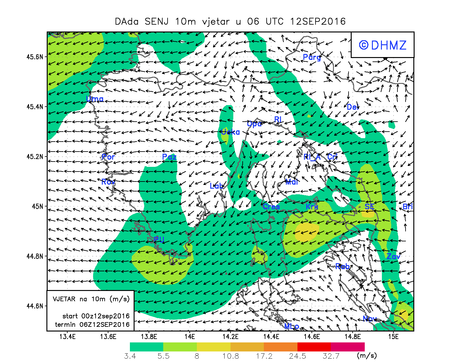
Note that this whole model covers an area of about 1x1 deg.
The global GFS model calculates only 16 points for this whole area at it's very best resolution of 0.25 degrees and gives you something like this:

Of course you have to keep on mind that even the local model is just as good as the historical data it is based on and the math implementing it - it is definitely not going to steer the
boat for you and the conditions you meet on the water may and will differ.
As to your "why?" Because they can and because they want. It does not mean you should or have to or that you are weird if you don't.
Pavel


 Linear Mode


 Recent Discussions