 |
|
 24-04-2011, 06:01
|
#751
|
|
Registered User

Join Date: Feb 2008
Location: Seattle, WA
Posts: 416
|
Re: Feature Requests: improve night mode icons
Quote:
Originally Posted by HamishB

I was looking on how to make the icons in night mode a bit easier to read ...
thanks,
Hamish
|
Thanks for looking into this. It has been on my list also. Unfortunately, I haven't spent any time investigating. This may qualify for more of a bug than a feature request. Perhaps we should post on the tracker along with your questions.
Will
|

|

|
|
26-04-2011, 06:51
|
#752
|
|
Registered User
Join Date: Mar 2010
Location: Canada
Boat: On the Hard
Posts: 336
|
Re: Feature Request-Hyperlinks on marks?
Thomas:
Was wondering how you grabbed the COGOW data as it looks very interesting.
/ch
|
|
|
|
|
26-04-2011, 11:03
|
#753
|
|
Registered User
Join Date: Dec 2005
Location: Helsingborg
Boat: Dufour 35
Posts: 3,891
|
Re: Feature Request-Hyperlinks on marks?
Quote:
Originally Posted by sailias
Thomas:
Was wondering how you grabbed the COGOW data as it looks very interesting.
/ch
|
The Format for the is like this:
Code:
http://cioss.coas.oregonstate.edu/cogow/0501/gif/21.25S_348.25E.gif
0501: 05 is month, 01 or 16 is day of month.
Positions are N or S lat. Long is 0 - 360 eastwards.
Lat and long can only have .25 or .75 as decimals, nothing else.
The position must be at sea. Inland positions will not work.

Thomas
|
|
|
|
|
26-04-2011, 11:59
|
#754
|
|
Registered User
Join Date: Mar 2010
Location: Canada
Boat: On the Hard
Posts: 336
|
Re: Feature Requests
Tks/ch
|
|
|
|
|
27-04-2011, 08:57
|
#755
|
|
Registered User
Join Date: Dec 2010
Location: oxnard, california
Boat: stich and glue, 19 ft wherry row/sail
Posts: 35
|
Re: Feature Requests
In case of gps failure or unsupported gps, I would like to have the
option of providing a text file or a form to input the gps coordinates
or dr position. The input should create a track.
thanks
|
|
|
|
|
27-04-2011, 10:58
|
#756
|
|
Registered User
Join Date: Mar 2010
Location: Canada
Boat: On the Hard
Posts: 336
|
Re: Feature Requests
gpsbabel is your friend for this. create a csv file with your data, convert it to gpx file format and import the gpx file via the route manager. Some experimenting with it should result in a track.
/ch
|
|
|
|
|
27-04-2011, 13:24
|
#757
|
|
Registered User
Join Date: Feb 2010
Posts: 619
|
Re: Feature Requests
Quote:
Originally Posted by oystercatcher
a form to input the gps coordinates
or dr position
|
Under right-click menu you have the option "Move Boat Here". This is the simplest form of DR plotting. It will create a track. You might want to drop a waypoint at a DR position before. The missing functionality will be: lack of ships lat-lon in status line and no distance calculation to WPTS and AIS targets.
Another way might be to use a GPS simulator (there are many products, commercial and freeware), that you periodically set with your current DR data, and feed the simulated GPS sentences (e.g. by Virtual Serial Ports Emulator or equivalent tool) into OCPN.
I would like indeed (if necessary, a settable option) to have full functionality also without valid GPS input.
|
|
|
|
|
27-04-2011, 14:10
|
#758
|
|
Registered User
Join Date: Jan 2010
Location: New Zealand
Posts: 286
|
Re: Feature Requests
Right click -> Jump to position
?
|
|
|
|
|
01-05-2011, 21:10
|
#759
|
|
Registered User
Join Date: Feb 2011
Posts: 5
|
Re: Feature Requests
I am a professional Pilot and have been using OpenCPN for a few months now. It is a great programme and has huge potential. I would like to make the following requests that will make the program better for pilots as well as the average sailor
1. The AIS target list is great but it would be even better if details shown could be selectable and scalable from all the available AIS data. It would also be of some benefit to me (and maybe a few others) to have the ability to save all the AIS data to a file at selectable intervals such as 10min, 30 min, 1 hour, 6 hour, 12 hour and 24 hour. This file can then be opened in an excel file for data extraction at a later date.
2. Presently there is no alarm if the GPS or AIS drops out. It would be useful to have this feature, particularly if navigating in a sensitive area.
3. Cross track error shows on the top right of the screen when the route is active. It would be nice to be able to set an alarm limit for each leg. It would also be nice to be able to set a global XTE limit as well as an individual leg XTE. This could be done from within the Route Manager and would also be very useful if it could be done from a right click menu on the active leg.
4. I don’t know if this is possible, but it would be nice and very useful to be able to place Parallel Index information on the screen. This could be done from within the right click menu to place one point on a geographical mark and another point anywhere on the track line. A small parallel course line shows on the geographical mark, a perpendicular line is drawn to the track line (or dotted extension of the track line) and the range is placed mid may along this perpendicular line. It would also be very good to have the ability to save this PI with the route. To really make this feature top notch, it would have the ability to also display a max and min PI from a geographical mark.
5. It would be great to have the ability to place text boxes, arrows, ellipses, rectangles, etc on the screen and saveable with the route. Then pertinent notes can be placed on the screen and retrieved every time the route is used without having to refer to a notebook. Very useful at night time.
6. The route manager would be good if it could be printed out like a passage plan. An additional input to make it more relevant would be the ability to input the start of route time. Then, the ETE time (not sure what ETE stands for??) could become the estimated real time of reaching a waypoint. It would also a good feature to be able to select real time and speed (from GPS input) so that at any one time we can see what the real time ETA’s will become.
|
|
|
|
|
02-05-2011, 10:34
|
#760
|
|
Registered User
Join Date: Dec 2010
Location: B.C.,Canada
Boat: 29'
Posts: 2,423
|
Re: Feature Requests
Code:
Quote:
Originally Posted by kaiviti
I am a professional Pilot and have been using OpenCPN for a few months now. It is a great programme and has huge potential. I would like to make the following requests that will make the program better for pilots as well as the average sailor
1. The AIS target list is great but it would be even better if details shown could be selectable and scalable from all the available AIS data. It would also be of some benefit to me (and maybe a few others) to have the ability to save all the AIS data to a file at selectable intervals such as 10min, 30 min, 1 hour, 6 hour, 12 hour and 24 hour. This file can then be opened in an excel file for data extraction at a later date.
2. Presently there is no alarm if the GPS or AIS drops out. It would be useful to have this feature, particularly if navigating in a sensitive area.
3. Cross track error shows on the top right of the screen when the route is active. It would be nice to be able to set an alarm limit for each leg. It would also be nice to be able to set a global XTE limit as well as an individual leg XTE. This could be done from within the Route Manager and would also be very useful if it could be done from a right click menu on the active leg.
4. I dont know if this is possible, but it would be nice and very useful to be able to place Parallel Index information on the screen. This could be done from within the right click menu to place one point on a geographical mark and another point anywhere on the track line. A small parallel course line shows on the geographical mark, a perpendicular line is drawn to the track line (or dotted extension of the track line) and the range is placed mid may along this perpendicular line. It would also be very good to have the ability to save this PI with the route. To really make this feature top notch, it would have the ability to also display a max and min PI from a geographical mark.
5. It would be great to have the ability to place text boxes, arrows, ellipses, rectangles, etc on the screen and saveable with the route. Then pertinent notes can be placed on the screen and retrieved every time the route is used without having to refer to a notebook. Very useful at night time.
6. The route manager would be good if it could be printed out like a passage plan. An additional input to make it more relevant would be the ability to input the start of route time. Then, the ETE time (not sure what ETE stands for??) could become the estimated real time of reaching a waypoint. It would also a good feature to be able to select real time and speed (from GPS input) so that at any one time we can see what the real time ETAs will become. |
Hi,kaiviti.I can't do anything about your requests but I'm interested in what a professional does up there in the wheelhouse and can you clarify?
Per 4:Sorry if I misunderstand.Please explain again if so...but is this "distance off" you're looking for?If so,can't you just set OpenCPN's so-called Radar Rings to say .10 miles to maintain an example 600 feet from a point?If there were two Range Rings that would satisfy min/max and might be easier to implement in O...
Per 5: if you place a mark,there's no apparent limit to what you can type in as a name.This could be your note and these could be selected and exported as a group in a gpx.You could give these all the same icon.
True,there's no second line and it could be untidy...
There was a lot more discussion in the same vein.did you see this thread?
http://www.cruisersforum.com/forums/...nts-57693.html
where much can be done,if you don't mind digging through
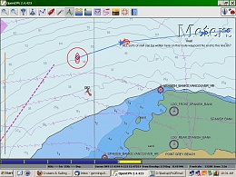
you can see the range circle? .1 miles.
|
|
|
|
|
02-05-2011, 15:18
|
#761
|
|
Registered User
Join Date: Feb 2011
Posts: 5
|
Re: Feature Requests
Thanks for your input HappySeagull. A range ring is useful if you want to steam around an object on a constant radius. A parallel index line is commonly used on a radar to give an offset track line to steam down. It is designed so that you keep on this line, particularly when travelling down a narrow channel. Unfortunately a range ring does not tell you accurately how far you are off your track line, particularly when the object you are referencing is still a fair way off. The min / max PI's are designed to ensure you keep within a safety margin of the dangers on either side of your track.
True, you can place a waypoint and give it a long one line description. No, I haven't read the full thread as yet, and I will. This is one solution to my request and I might expand on that by requesting that the option be included to increase the description to more than one line. Also, in the selection of icons we add one that is "Note".
One more request I would like to make. Many navigation lights are sectored with different colours. The symbol on the chart is generally so small that it is hard to determine the angles on the sectors. Might I request a feature where if the vessel is within a certain range of a light that the sector you are in be shown on the chart as a transparent arc and of the relevant colour of the sector. A right click option to turn on or off would be useful.
|
|
|
|
|
02-05-2011, 18:50
|
#762
|
|
Registered User
Join Date: Jan 2010
Location: New Zealand
Posts: 286
|
Re: Feature Requests
Quote:
Originally Posted by kaiviti
This is one solution to my request and I might expand on that by requesting that the option be included to increase the description to more than one line.
|
one thing that doesn't happen currently, but could be considered and I suspect implemented without too much difficulty, is sticking '\n' into the the descriptive text:
Code:
This is one line.\nThis is another line.
The GPX <description> tag itself will be limited to a single line, but newline aliases within that can be interpreted (or not) if the end-user software wishes.
Hamish
ps- after ideas for wishes are well formed please file in the flyspray ticket tracker: OpenCPN::Tracker OpenCPN - Feature Requests: Tasklist
|
|
|
|
|
02-05-2011, 18:51
|
#763
|
|
Registered User
Join Date: Jan 2010
Location: New Zealand
Posts: 286
|
Re: Feature Requests
(one wish per ticket please, 4 wishes = 4 tickets or else it just gets too confusing)
|
|
|
|
|
03-05-2011, 08:47
|
#764
|
|
Registered User
Join Date: Mar 2010
Location: Canada
Boat: On the Hard
Posts: 336
|
Re: Feature Requests
One feature that would be very nice is panning when you are creating routes. As it currently works, if you draft a route at a certain level, and it goes past the screen on your display you need to end the route, pan over, amend waypoint and continue on....then repeat.Planning a route of some 100 knautical miles it gets interesting if you are coastal cruising. Is this already implemented and Im just not getting it. Once I get some feedback, ya or nay, will enter it on flyspray.
Best regards
/ch
|
|
|
|
|
03-05-2011, 09:07
|
#765
|
|
Registered User
Join Date: May 2010
Posts: 16
|
Re: Feature Requests
First of all, I want to thank all of you who make this program possible. And I'm amazed at how attentive you have been to my questions. I am not a programmer, so i feel somewhat like a lurker for even making a request, but I'll take the risk.
I have used Polar View for a couple of weeks now and am still struggling to remember all of the commands. I usually get frustrated and open CPN instead. It is so intuitive and easy, I love it.
But the one thing about Polar View that I absolutely love is the object query feature. It opens in a formatted table format with all information in one single view. CPN is not nearly as clean in its presentation, plus it requires me to dig down one level to see the details about an object. Plus, I have to resort to a translation table to understand the acronyms used.
Okay, I said it. If I've offended anyone -- I profusely apologize. I'm just offering some feedback from a new set of eyes.
|
|
|
|
|
|
| Thread Tools |
Search this Thread |
|
|
|
| Display Modes |
Rate This Thread |
 Linear Mode Linear Mode
|
|
 Posting Rules
|
You may not post new threads
You may not post replies
You may not post attachments
You may not edit your posts
HTML code is Off
|
|
|
|
Advertise Here

 Recent Discussions Recent Discussions |
|
|
|
|
|
|
|
|
|
|
|
|
|
|
|
|
|
|
|
|
|
|
|
|
|
Vendor Spotlight |
|
|
|
|
|
|
|
|
|


