Version:1.0 StartHTML:0000000167 EndHTML:0000002752 StartFragment:0000000484 EndFragment:0000002736 Chart boarders
I'm testing opencpn on mine Macbook to see if its fits mine needs. I use
enc charts from
iENC | RIS portal Nederland but they are still in a very preliminary state (no
depth lines) etc and mine own scanned chart set. Converted them with RasterChart2BSB to a *.kap file and implemented them into opencpn so far went all good only when sailing from the Haringvliet out to the Northsee I noticed I was still on the Haringvliet chart but on the outside of the lock at the North sea without a proper vieuw of the boys etc. fig 1 is at the Oosterschelde passing the bridge you have to switch to the next chart but on the last one is still a blank place without navigational info and opencpn switch only to the next chart if you pass the border of the chart where you where on at that moment.

I
solved the problem by hand due to drawing a
route across the charts boarders
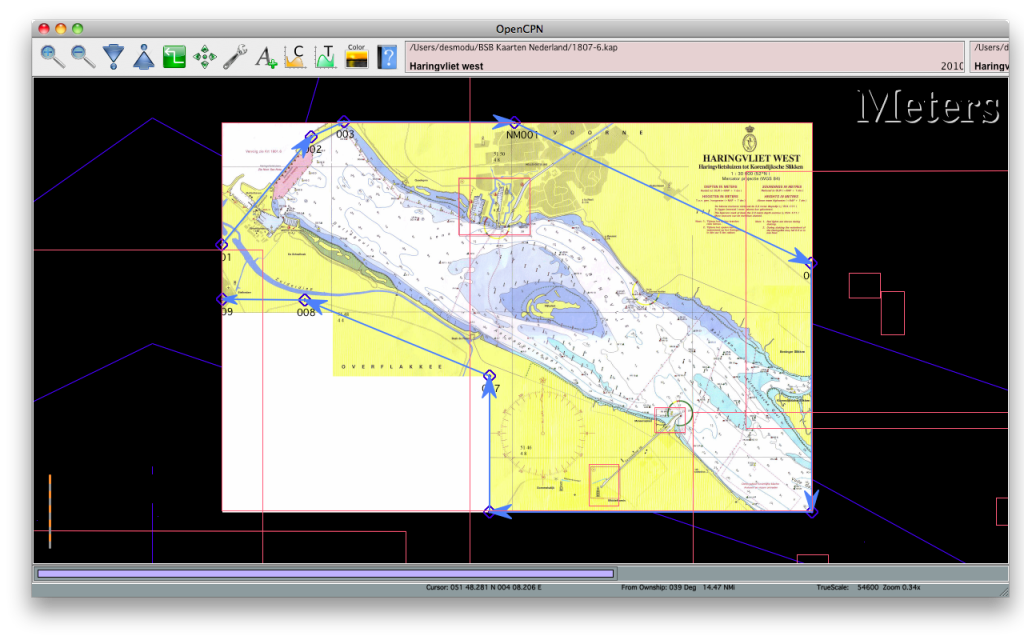
Saving this
route as a gpx file and opening this in a text editor

Leaving the lat and lon data and getting rid of the rest will leave you with two collums of lat lon data of the route marks then completing each line so it will look like this PLY/<follow number>, <xx.xxxxx>,<yy.yyyyyy>

Open the .kap file which you draw the route outline on and select the 4 lines which begin with PLY
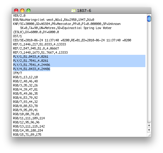
Paste the lines in this kap file you just made so it will look like this

Force a chart data base
rebuild within opencpn and voila when passing the bridge next chart will be active also. One question is remaining if it also possible that data outside the chart boarders won't show up in Opencpn
Mine thought now is it should be reasonable easy to make work within Opencpn by just making a tool like route manager and then applying it in the chart in one go. I would do it but it is far beyond mine programming knowledge.


 Having the toolbar on the right-hand side of the
  It would enable the Look Ahead Mode to look, umm, further ahead
 think would be nice to have a is a tool where i could draw the outline of the chart I want which paste this into the Kap file and opencpn would only show what would be inside this outline. chart quilting would be a lot nicer to look at I think.


 Linear Mode


 Recent Discussions